


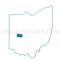
Voting District CONCORD, Champaign County, Ohio
About
Outline

Summary
| Unique Area Identifier | 643324 |
| Name | Voting District CONCORD |
| County | Champaign County |
| State | Ohio |
| Area (square miles) | 30.16 |
| Land Area (square miles) | 30.09 |
| Water Area (square miles) | 0.07 |
| % of Land Area | 99.76 |
| % of Water Area | 0.24 |
| Latitude of the Internal Point | 40.16878130 |
| Longtitude of the Internal Point | -83.84959060 |
Maps


Graphs
Select a template below for downloading or customizing gragh for Voting District CONCORD, Champaign County, Ohio


Neighbors
Neighoring Voting District (by Name) Neighboring Voting District on the Map
- Voting District ADAMS, Champaign County, OH
- Voting District HARRISON, Champaign County, OH
- Voting District JOHNSON, Champaign County, OH
- Voting District MAD RIVER A, Champaign County, OH
- Voting District MAD RIVER B, Champaign County, OH
- Voting District SALEM NORTH, Champaign County, OH
- Voting District SALEM SOUTH, Champaign County, OH
- Voting District URBANA NORTH, Champaign County, OH
Top 10 Neighboring County Subdivision (by Population) Neighboring County Subdivision on the Map
- Urbana township, Champaign County, OH (14,795)
- Johnson township, Champaign County, OH (3,506)
- Mad River township, Champaign County, OH (2,821)
- Salem township, Champaign County, OH (2,539)
- Concord township, Champaign County, OH (1,422)
- Adams township, Champaign County, OH (1,110)
- Harrison township, Champaign County, OH (932)
Top 10 Neighboring Unified School District (by Population) Neighboring Unified School District on the Map
- Urbana City School District, OH (15,342)
- Graham Local School District, OH (11,965)
- West Liberty-Salem Local School District, OH (5,986)
Top 10 Neighboring State Legislative District Lower Chamber (by Population) Neighboring State Legislative District Lower Chamber on the Map
Top 10 Neighboring State Legislative District Upper Chamber (by Population) Neighboring State Legislative District Upper Chamber on the Map
Top 10 Neighboring 111th Congressional District (by Population) Neighboring 111th Congressional District on the Map
Top 10 Neighboring Census Tract (by Population) Neighboring Census Tract on the Map
- Census Tract 102, Champaign County, OH (7,260)
- Census Tract 115.01, Champaign County, OH (4,473)
- Census Tract 104, Champaign County, OH (4,150)
- Census Tract 110.01, Champaign County, OH (2,702)